
Reviewed · ANDES MOUNTAIN TOURS
Wonders of the High Andes from Mendoza
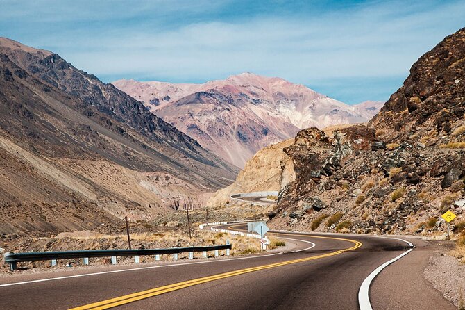
The big draw here is the High Andes in one long, dramatic day. From Mendoza, you follow the Mendoza River toward Potrerillos, Uspallata, Puente del Inca, Aconcagua, and the Chilean border. It is a road trip through changing colors, rock formations, old settlements, and very high mountain air.
I like two things in particular: you see far more than you could comfortably manage by car in one day, and the route reaches places that give Mendoza its sense of scale. The included pickup and air-conditioned vehicle also remove the strain of driving unfamiliar mountain roads.
The trade-off is simple: this is a long excursion, with roughly 10 hours on the road and a possible return around 8 p.m. in summer if the Cristo Redentor road is open. English guiding can also be uneven, so confirm that point before booking.
High Andes tour highlights at a glance
- Potrerillos Dam and the Mendoza River: See the water system that supports irrigation and power across the region.
- Uspallata’s pre-Hispanic setting: Visit an area linked to the Huarpe people and the southern edge of the Inca Empire.
- Puente del Inca: Stop at the famous natural bridge and its mineral-colored hot springs.
- Aconcagua viewpoint: Get a photo stop near the highest mountain in the Western Hemisphere, listed here at about 6,900 meters.
- Las Cuevas at 3,200 meters: Reach an unusual mountain village near the Chilean border.
- Cristo Redentor: Visit the monument symbolizing friendship between Argentina and Chile when weather and road traffic permit.
Why this is the easiest way to see Mendoza’s high country
The Andes road runs a long way from Mendoza. You are covering roughly 400 kilometers along Routes 40 and 7, depending on the exact route and stops. That explains both the appeal and the tiring nature of the excursion.
A rental car gives you more control, but it also leaves you to handle mountain driving, navigation, weather changes, and the border-region road yourself. Here, an air-conditioned vehicle does the work while you watch the scenery change from the dry outskirts of Mendoza to bare, towering peaks.
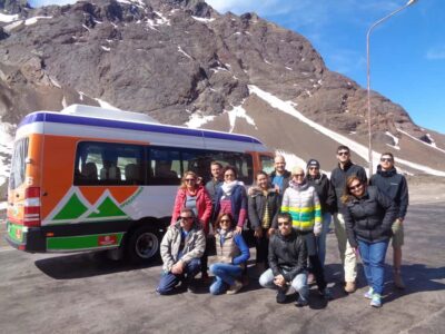
The group may be as large as 40 people. Some departures use a minibus, while others may use a larger vehicle, so do not book this expecting a private or semi-private outing. The vehicle size matters on a full-day trip. Several people have found the ride cramped, especially when the vehicle is full.
Pickup begins around 7:30 a.m. from selected hotels in Mendoza. The exact pickup time can vary as the vehicle collects people around the city, so be ready early and check the final instructions carefully. A delayed pickup or an unclear meeting point can create unnecessary stress before a very long day.
More days in the Andes around Mendoza:
- From Mendoza: High Andes Aconcagua Mountain Tour
★ 4.4 · 767 reviews - Andes Day Trip from Mendoza Including Aconcagua, Uspallata and Puente del Inca
★ 4.5 · 419 reviews - From Mendoza: Andes High Mountain Full-Day Tour
★ 4.7 · 208 reviews
From Potrerillos Dam to Uspallata
The first stretch follows the Mendoza River, with views toward the Cordon del Plata range and Potrerillos Dam. The dam is not just a photo stop. It supplies water for irrigation and helps generate power for the wider region, making it an important part of daily life in this dry part of Argentina.
This early section gives you a useful visual lesson in the Andes. The mountains are not one solid wall. Their colors and shapes shift constantly, with dry hills, sharp ridges, pale rock, and broad river valleys appearing along the road.
Uspallata is the first substantial stop, lasting about an hour. The area has links to pre-Hispanic Huarpe communities and marks the southernmost reach of the Inca Empire. It is a good place to stretch your legs, use facilities, and begin adjusting to the scale of the mountains.
Do not expect a long hike here. This is mainly a sightseeing and interpretation stop. The guide’s explanation makes a difference, particularly if you want more than photographs. Guides such as Federico, Rocío, Paula, Esteban, and Javier have been praised for clear explanations on different departures, but the quality of English delivery can vary from one day to another.
Picheuta, Polvaredas, and Punta de Vacas
The route continues through the small mountain communities and historic points around Picheuta, Polvaredas, and Punta de Vacas. The stop at Puente Picheuta brings you to an old bridge and the remains of an earlier route through the valley.
These places are modest rather than polished. That is part of their appeal. You are seeing working mountain settlements and remnants of travel routes instead of a purpose-built attraction. The stops also break up the long drive, which becomes increasingly important as the day goes on.
Allow yourself to be flexible. The tour schedule includes set stop lengths, but road conditions, traffic, weather, and the pace of the group can affect the day. Some people find the stops too brief, while others appreciate having enough time for a quick walk and photographs without making the return impossibly late.
Penitentes and the high road toward Chile
Los Penitentes is a former or seasonal ski area with wide views of the surrounding peaks. The entrance is not included, and the stop is mainly about seeing the mountain setting rather than taking part in a ski activity.
The name refers to the jagged snow and ice formations that can resemble kneeling figures. Conditions vary by season, and the resort may not be operating when you visit. In winter, fresh snow can transform the entire route, but poor weather can also reduce visibility or close upper roads.
This is where clothing becomes practical, not optional. Bring a warm layer even if Mendoza feels sunny and mild in the morning. Temperatures can drop sharply at higher elevations, and wind can make short photo stops uncomfortable.
A few more Mendoza days worth comparing
- From Mendoza: 3 Wineries, Olive Oil Factory Tour & Tasting
★ 4.6 · 901 reviews - Mendoza: Half-Day Wine Tour with Tastings
★ 4.3 · 727 reviews - Mendoza: Sunset Horse Back Riding in the Mountains and BBQ
★ 4.9 · 515 reviews - Premium Spa Day at Cacheuta Hot Springs
★ 4.5 · 160 reviews
Puente del Inca, a natural bridge with hot springs
Puente del Inca is one of the most memorable stops on the route. The natural rock bridge crosses the river and is colored by mineral deposits from the hot springs below and around it. The result looks almost built by hand, though it is a geological formation.
The stop is short, listed at about 10 minutes, so your expectations should be realistic. You will have time to see the formation and take photographs, but not to wander widely or settle in for a long visit.
The area can also be where altitude symptoms first appear. One person became unwell here with nausea, dizziness, tiredness, shortness of breath, body aches, and blurred vision, then felt worse near Cristo Redentor. You may feel perfectly fine, but the warning is worth taking seriously. Move slowly, drink water, and tell the guide if you feel ill.
Aconcagua viewpoint and the highest peaks
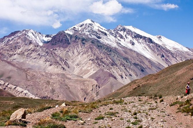
The Aconcagua viewpoint is the main prize for many people. Aconcagua rises to about 6,900 meters and is the highest mountain in the Western Hemisphere. The stop lasts around 30 minutes, giving you time for photographs and a chance to take in the scale of the mountain country.
Visibility is never guaranteed. Clouds can cover Aconcagua, and the viewpoint may show a wall of gray instead of a clear summit. That is not a failure of the excursion. It is simply mountain weather, and conditions can change quickly.
The exact viewing point may also vary. Some departures stop near the road rather than at the most obvious viewpoint sign. Keep your expectations focused on the high Andes rather than one perfect photograph.
For geology fans, this section is especially rewarding. The rock colors vary from peak to peak, and the bare terrain shows how much the Andes change over short distances. Even without a clear view of Aconcagua, the route gives you a strong sense of the forces that shaped the range.
Las Cuevas at 3,200 meters
Las Cuevas is the final village before the international tunnel toward Chile. It sits at about 3,200 meters, or 10,500 feet, and has an unusual European-style appearance. The altitude is obvious here. The air can feel thin, walking may seem harder than expected, and even a short stroll can leave you tired.
The scheduled stop is about an hour. In practice, this is often the main meal break and a chance to look around. Food and drinks are not included, and the restaurant choices in this remote area can be expensive. Quality has been inconsistent, with some people finding the meals poor and the facilities disappointing.
I would bring snacks and water from Mendoza, even if you plan to buy lunch. A meal purchase may still be convenient, but you should not depend on the roadside restaurant for a highlight of the day. A water bottle is particularly useful, and one traveler suggested filling it from a mountain stream, but only do so if the guide confirms that the water is suitable.
Cristo Redentor and the final climb
Between Las Cuevas and the international tunnel, a mountain road leads toward Cristo Redentor de los Andes. The monument sits at about 4,200 meters, or 13,780 feet, and represents the union of Argentina and Chile.
Reaching it is one of the most memorable possibilities on the excursion, but it is not guaranteed. The visit operates only from January through March and depends on weather and traffic, including heavy international road traffic. Snow, road conditions, and congestion can keep the vehicle from going up.
This point deserves careful attention when you compare tours. The advertised route includes Cristo Redentor, but the day may finish without reaching it. If the road is open, the excursion can return around 5:30 p.m. If the group goes up to the monument in summer, the return may be closer to 8 p.m.
The monument itself is simple, powerful, and isolated. The value comes from the setting and the border symbolism, not from a long visit or elaborate facilities. If the road is closed, you still receive a full mountain route, but the final stop will be missing.
Guides, language, and group size
The tour includes an English and Spanish guide, but English service is the most important point to confirm before you pay. Some departures have had guides who spoke very good English and made sure everyone understood. Rocío, for example, was praised for handling the route clearly, while Federico was able to speak Spanish and then repeat the information in English at a pace that worked for an English-speaking passenger.
Other departures have been less successful. One guide did not speak English, and another English-speaking passenger had to rely on short explanations from a guide on a different vehicle. A printed information sheet in English would help, but it is not listed as included.
Ask the operator to confirm that an English-speaking guide will be present on your date. Do not assume that the general promise of a bilingual service guarantees equal interpretation throughout the day.
Group size can reach 40 people. Some departures have used Mercedes Sprinter vehicles with about 16 people, while others have been much fuller. This is a regular group tour, not a small private trip, and that distinction affects space, stop times, and the overall pace.
Is the $67 price good value?
At $67 per person, the tour is reasonably priced for a full day of transport, hotel pickup from selected hotels, a professional guide, and a route reaching the high Andes. A car rental would bring extra costs and responsibilities, while an independent visit would be difficult to organize in one day.
The price does not include lunch, drinks, entrance fees where applicable, or personal expenses. The Penitentes entrance is specifically excluded, though the itinerary does not require a paid activity there. Budget for food in Las Cuevas, but bring backup snacks in case the available meal is expensive or unappealing.
The value is strongest if you want access to many distant sights without driving. It is weaker if you expect a small group, generous walking time, or a polished food experience. You are paying mainly for the route and transport, not for an activity-packed mountain adventure.
What to bring for a better day
Pack for several climates. Mendoza may be warm at departure, while Las Cuevas and Cristo Redentor can be cold, windy, or snowy.
Bring:
- A warm jacket or fleece
- Water and snacks
- Sun protection
- Comfortable shoes for short walks
- Medication you normally use for motion sickness or altitude concerns
- A phone or camera with spare battery power
Do not plan this as a serious hiking day. The itinerary consists mostly of scenic stops, short walks, and time in the vehicle. The main physical issue is altitude, especially above Uspallata and near the upper border road.
Cancellation is free if you cancel at least 24 hours before the start time. Poor weather can lead to a new date or a full refund, but last-minute changes inside 24 hours are not accepted.
Should you book the High Andes from Mendoza?
I would book this if you want the broadest possible introduction to Mendoza’s mountain country in one day and you are comfortable with long hours in a vehicle. The route is varied, the scenery is striking, and the chance to see Aconcagua, Puente del Inca, Las Cuevas, and possibly Cristo Redentor makes the $67 fare fair.
I would hesitate if you need a guaranteed English-speaking guide, dislike full vehicles, have difficulty with altitude, or want long walks at each stop. Confirm the guide language, pickup point, group size expectations, and Cristo Redentor access before booking.
For most independent visitors without a rental car, this is a practical way to reach the High Andes. Just treat it as a demanding mountain road day, not a relaxed sightseeing loop.
FAQ
How long does the High Andes tour last?
The tour takes about 10 hours. In summer, if the vehicle reaches Cristo Redentor, the return can be around 8 p.m.
What time does the tour start?
The scheduled start time is 7:30 a.m., with pickup from selected Mendoza hotels.
Is hotel pickup included?
Yes, hotel pickup and drop-off are included for selected hotels. The vehicle may collect passengers around the city, so the exact pickup time can vary.
Is food included?
No. Food and drinks are not included. You should budget for lunch and consider bringing snacks and water.
Does the tour reach Cristo Redentor every time?
No. Access depends on weather conditions and traffic on the mountain route. The visit is available only from January through March.
How high is Las Cuevas?
Las Cuevas is about 3,200 meters above sea level, or approximately 10,500 feet.
How high is Cristo Redentor?
The Cristo Redentor monument is about 4,200 meters above sea level, or approximately 13,780 feet.
Is an English-speaking guide included?
The tour includes an English and Spanish guide, but English delivery can vary by departure. Confirm this directly before booking if English commentary is important to you.
What is the cancellation policy?
You can cancel for a full refund up to 24 hours before the experience begins. If poor weather causes the tour to be canceled, you will be offered another date or a full refund.
Just added around Mendoza
- Mendoza: Premium Wine Tasting★ 4.4 · 48 reviews
- Mendoza: Wine Tasting Tour with Lunch and Private Transport★ 4.6 · 48 reviews
- Mendoza: Winebike Tasting Tour with Optional Lunch★ 4.1 · 73 reviews
- Mendoza: River Rafting & Canopy in the Andes Mountain Range★ 4.2 · 57 reviews
- Mendoza: 12-KM River Rafting Tour in the Andes★ 3.9 · 94 reviews
- Mendoza: Paragliding Tandem Flight with Instructor★ 4.8 · 42 reviews
- Mendoza: High Mountain Experience, a Tour through the Andes★ 4.5 · 78 reviews
- From Mendoza: Premium Spa Day at the Cacheuta Hot Springs★ 4.5 · 60 reviews
Andes Mountain Tours, compared.
Andes Day Trip from Mendoza Including Aconcagua, Uspallata and Puente del Inca
Read our review →
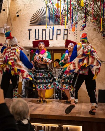
Cusco: Folkloric Andean Show & 3-Course Dinner at Tunupa
Read our review →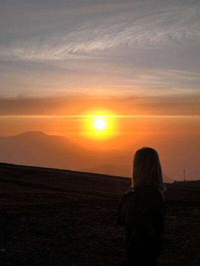
Andes Mountains Sunset and Valle Nevado & Picnic
Read our review →
Browse the lists this tour appears in